264 Cruise
Text and Photographs by David Swanson.
 |
One of my goals when I take my boat vacation each year is to have some sort of theme. Sometimes it may be to see a new area, or to circumnavigate some body of water or peninsula. This trip ended up being shorter than normal due to work, weddings, and weather, and less structured than normal. By the end of the trip an unusual theme had emerged: This was the US-264 cruise.
I arrived at Potters Marine at 10:00 on Friday morning, and by the time I got unpacked, launched the dinghy and cast off lines it was nearly noon. The weather was typical late summer – hot, humid, almost no wind. Still, it was good to be on the water.
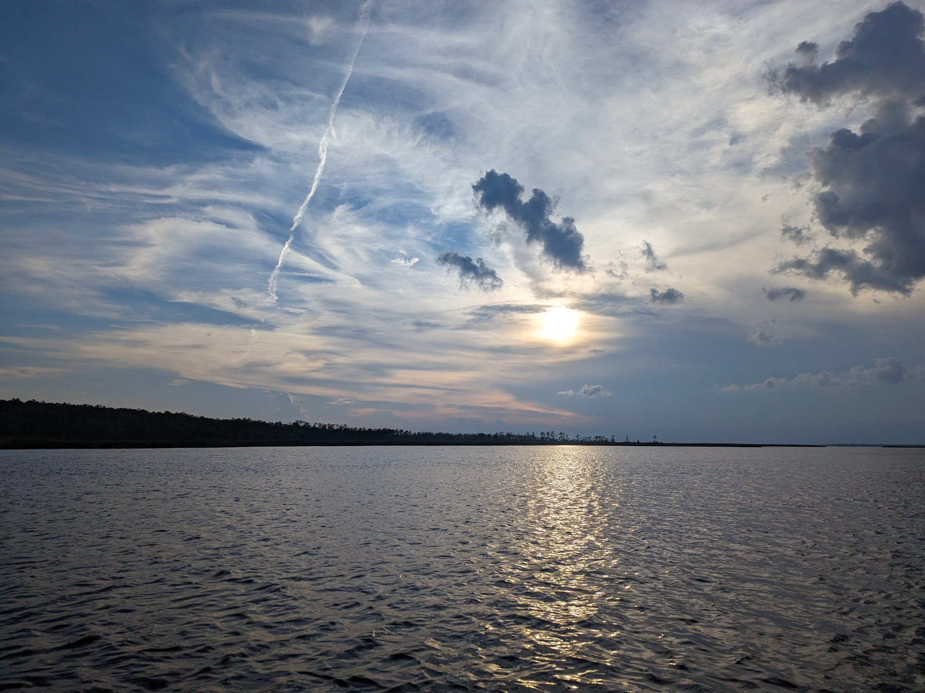
I motored out past 1NC to the Pamlico River and turned east. By 1:00 the wind had started to pick up and I raised the main sail and staysail. By the time I reached the Pamlico River junction buoy the wind had gone to 15 knots, then 20 knots from the south. The river/sound junction was the usual mess of standing waves from different directions as the two different river currents collided with each other and the Pamlico Sound. We turned north and headed toward Belhaven with two to three foot breaking waves and plenty of wind. This was about the time I realized that I had neglected to reeve the reefing line when I put the sails back on Flying Beagle after Hurricane Idalia.
 |
We made it to the Belhaven channel marker and followed the river channel east, thinking that the wind and waves would be less once we got in the lee of the land. Well I was half right, the waves dropped down some but veered to ESE at 15 to 20. After struggling along with the main scandalized and not quite able to make our course, I dropped the sails in front of Dowry Creek and fired up the engine. From there it was a fairly short motoring trip into Scranton Creek. Once anchored, I discovered that my dingy was partially flooded from water coming up the daggerboard slot. I will need to make a cap for this in the future. Otherwise it was a quiet evening after a good day’s sail.
Navigation to the creek mouth of Scranton Creek is easy, even at night – just steer for the radio tower. When you reach red Pungo River Channel Light “18”, curve slightly north until you are past the charted 4 foot soundings off Broad Creek Point, then turn south and follow the channel into Scranton Creek. The channel is unmarked, stay near the middle of the creek & watch your depth sounder. There is good depth and protection on the creek but do NOT go in to where the submerged pilings are shown on the chart. Exploring in the dinghy later I found several pilings that were just slightly below the water level. Otherwise this is a great anchorage, with good scenery. There was some slight noise from the road at the head of the creek, which Google Maps told me was US-264.
 |
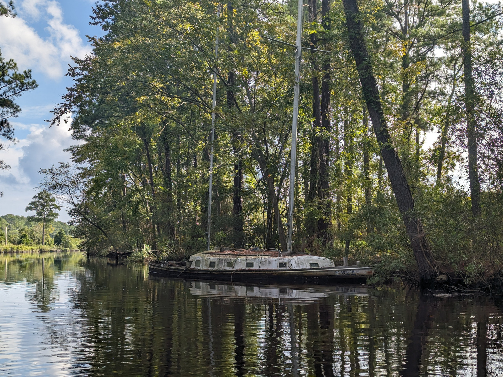
Saturday morning brought a forecast of thunderstorms. After coffee I briefly explored the area in my dinghy Woodstock. There was no sign of the sunken fishing vessel that Google Maps showed by the US-264 bridge, but there was a semi-sunken sailboat on an offshoot of the creek, and a lot of submerged pilings.
I raised anchor at 9:15 am and motored toward Belhaven with a thunderstorm hard on my heels. Discretion being the better part of valor, I high-tailed it straight into Belhaven and tied up at Belhaven Marina, just a block off US-264. This is one of my favorite marinas and Greg the dock master is always friendly and helpful. This is usually a fairly protected spot but the south wind made it rather rolly and wave after wave of thunderstorms blew over us. I had a milkshake for lunch at Cloud 9 Creamery (highly recommended) and dinner at the Tavern at Jack’s Neck (pretty good pizza). Later that night we were hammered by a couple thunderstorms and once again the dinghy was flooded.
 |
I slept in Sunday as it was spitting rain in the morning, them left the dock at 11:00 am. Wind was very light SW and the sky was overcast. We headed east up the Pungo River again under power, anchoring on the Upper Pungo (past where the Alligator River-Pungo River Canal entrance is) at 2:30 pm. This was another really good anchorage, with scattered light development on the northern shore and marsh and woods on the southern shore, The river curves around enough that you can find a spot with good protection from any wind. It is navigable almost all the way up to US-264. I napped and explored in the dinghy as I had not been up this arm of the Pungo before. That night I sat in the cockpit in a cloud of "Deep Wood Off" and watched the stars, lightning from a thunderstorm way off over the Outer Banks, and even saw a string of Starlink satellites fly by.
Monday morning was cool and almost no wind. I left the Upper Pungo at 8:15 am and motored slowly downstream. There was a light SW wind on the broad section of the river near Belhaven so I raised the sails and slowly tacked south toward the sound. I was surprised to find that red “WR2” and green “3” had both been replaced with buoys, something I did not notice on my way north on Friday.
 |
The wind kept dropping, and by 3:00 pm I was forced to take in sail and motor. Fifteen minutes later the wind filled in from the NW at around 15 knots. Sloth set in, and rather that raise the sails and tack into South Creek I motored west behind Indian Island. After some indecision, I changed my course toward Bond Creek, another place I had not yet explored. I quickly found that Bond Creek suffered from the same problem as the upper reaches of Scranton Creek – submerged pilings. There were pilings near red “2”, and then between “2” and “3”. There was also more shoreline development than I expected, all of it on the eastern side of the creek. I anchored in a well protected spot that was not quite in someones back yard at 6:00 pm. It was very quiet, and the west side of the creek is quite scenic. And this was the only anchorage that was NOT near US-264.
Tuesday morning again brought no wind. Anchor was up at 7:30 am, and we motored (slowly and carefully) out the creek and past the east end of Indian Island. A short shot across the Pamlico River brought us back to Potters. All in all this was a good trip, even though I covered very little ground and motored more than I sailed. I visited three new-to-me anchorages and will definitely be back to two of them (Scranton Creel and Upper Pungo River).
A few more photographs:
 |
 |
 |
 |
Text and Photographs by David Swanson Posted 05/10/24.
Copyright © 2024 Paul M. Clayton, David Swanson.